A hack I found useful to add Google Maps / Google Satelite View / Bing Maps / Bing Arial / Open Street Maps in Forsk Atoll.
Close Atoll,
Go to C -> Program Files -> Atoll
Edit the file named atoll.ini
Paste the following into it:
[OnlineMaps]
Name1 = OpenStreetMap Standard Map
URL1 = http://a.tile.openstreetmap.org/%z/%x/%y.png
Name2 = MapQuest Open Aerial
URL2 = http://otile1.mqcdn.com/tiles/1.0.0/sat/%z/%x/%y.jpg
Name3 = 2Gis
URL3 = http://static.maps.api.2gis.ru/1.0?c...z&size=256,256
Name4 = 2Gis without logo
URL4 = http://tile2.maps.2gis.com/tiles?x=%x&y=%y&z=%z&v=37
Name5 = Bing Aerial
URL5 = http://ecn.t3.tiles.virtualearth.net.../a%q.jpg?g=392
Name6 = Bing Hybrid
URL6 = http://ecn.t3.tiles.virtualearth.net.../h%q.jpg?g=392
Name7 = Bing Road
URL7 = http://ecn.t3.tiles.virtualearth.net.../r%q.jpg?g=392
Name8 = Yandex Road
URL8 = http://static-maps.yandex.ru/1.x/?ll...=%z&l=map&key=
Name9 = Yandex Aerial
URL9 = http://static-maps.yandex.ru/1.x/?ll...=%z&l=sat&key=
Name10 = Yandex Hybrid
URL10 = http://static-maps.yandex.ru/1.x/?ll...l=sat,skl&key=
Name11 = ArcGIS
URL11 = http://services.arcgisonline.com/Arc...e/%z/%y/%x.png
Name12 = opencyclemap
URL12 = http://tile.opencyclemap.org/cycle/%z/%x/%y.png
Name13 = Google Terrain
URL13 = http://mt.google.com/vt/lyrs=t&hl=en&x=%x&y=%y&z=%z
Name14 = Google Map
URL14 = http://mt.google.com/vt/lyrs=m&hl=en&x=%x&y=%y&z=%z
Name15 = Google Hybrid (Map + Terrain)
URL15 = http://mt.google.com/vt/lyrs=p&hl=en&x=%x&y=%y&z=%z
Name16 = Google Hybrid (Map + Satellite)
URL16 = http://mt.google.com/vt/lyrs=y&hl=en&x=%x&y=%y&z=%z
Name17 = Google Satellite
URL17 = http://mt.google.com/vt/lyrs=m&hl=en&x=%x&y=%y&z=%z
Name18 = Google Scheme
URL18 = http://mt.google.com/vt/lyrs=h&hl=en&x=%x&y=%y&z=%z
Name19 = Google Scheme2
URL19 = http://mt.google.com/vt/lyrs=r&hl=en&x=%x&y=%y&z=%z
Save and open Atoll,
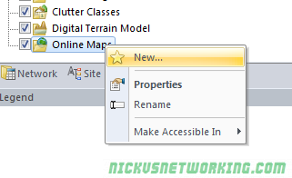
Open the Geo Tab,
Right click on Online Maps, click “New”
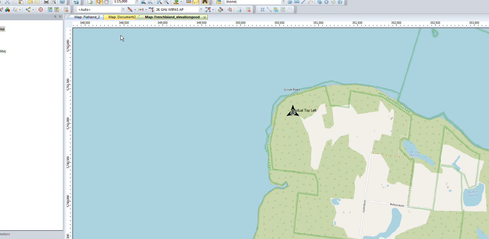
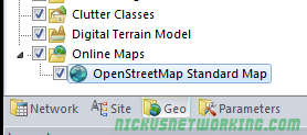
Select the map source (In this example I’m using OSM) & hit Ok.

Enable the Online Map layer by ticking the layer.
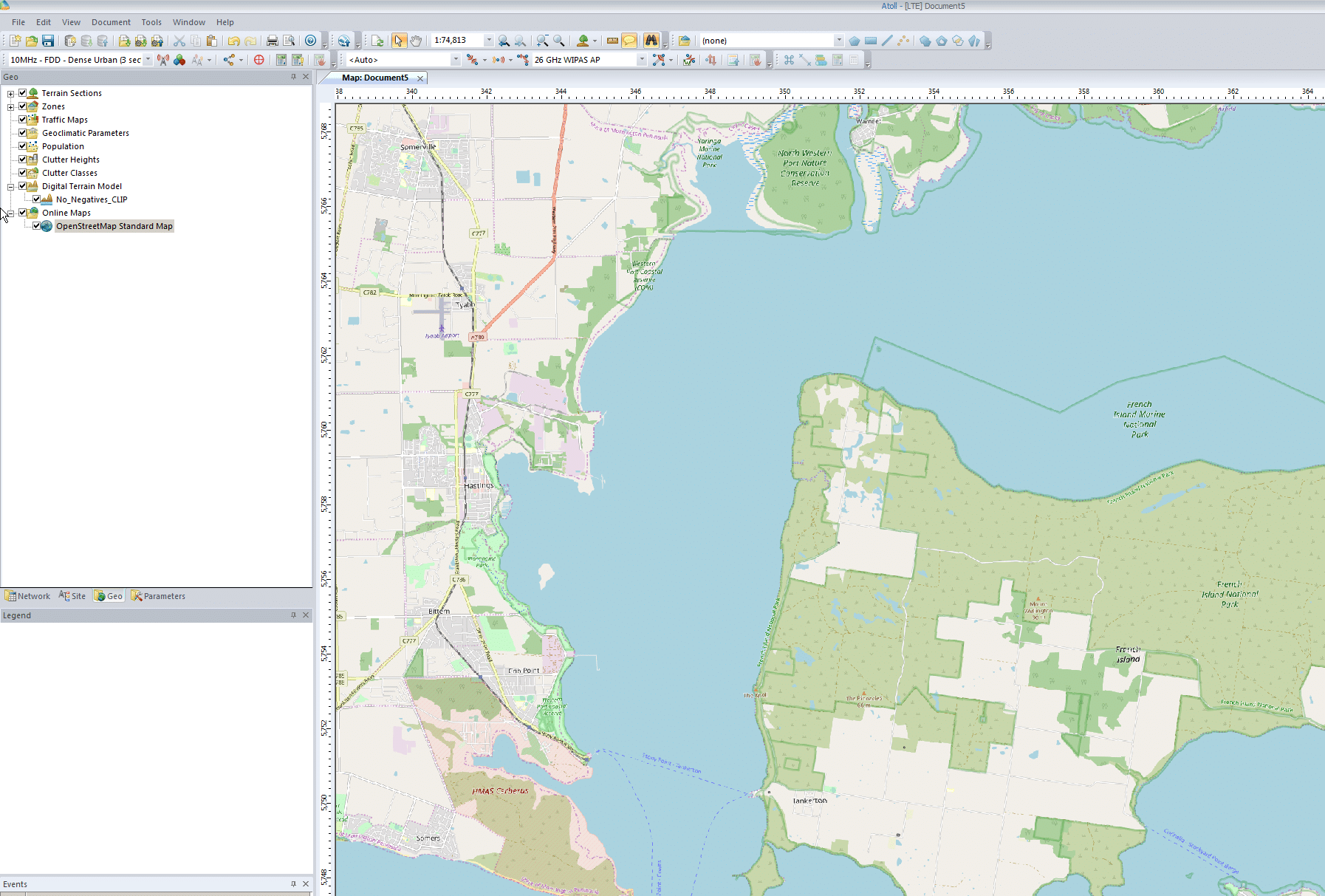
Bam, done.
Thanks
Hello. You have great information on your site.
I am not able to get the online map tiles to work in Atoll.
The event viewer returns “ERROR 5/5/2022 – 2:33:03 PM HTTP Status: 400 Status Text returned by the server : Bad Request” for all of the URLs you provided.
Thanks again for all of the great information.
Please disregard my last message. I figured it out. Thanks again.
Thanks for your hack, did you notice the poor resolution of the maps? I mean that the image is pixelized
This is very helpful.
Is there anyway we can remove the street names and other logos?
I only managed to get access to Open Street Maps. all the other ones didn’t work.
I got messages like “12007 HttpSendRequest The name or server address could not be resolved” and “HTTP Status: 404”
Does anyone knows how to solve this?